 iTEL
iTEL
Search results: 263
RC31403(UMSFLEC) Perladangan Persis [2-2025/2026]
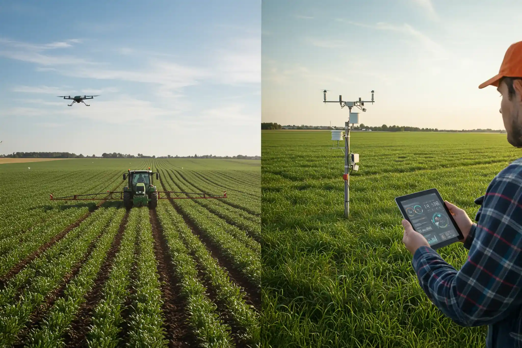
This course introduces students to the concepts, technologies and applications involved in precision farming (PF). This entails the use of ICT and some high-technology equipment for assessing field conditions and applying variable rates of production inputs for management of soil nutrients, weeds, pest & diseases. Topics include sampling procedures, and measurements of parameters through environmental sensors, GNSS, RS and PS. Data input into GIS or analysis using Geo-statistical & Mapping software to accomplish primary spatial data management tasks, creation of spatial variability maps for mechanized applications of farm inputs. Students will also be exposed to precision technologies in livestock production for locating as well as feeding, reproduction and health management. Students will participate in some hands-on experience in the use of enabling hardware and software in PF applications.
![RH20303 PROPAGASI TUMBUHAN DAN PENGURUSAN SEMAIAN [1-2024/2025]](https://itel.ums.edu.my/pluginfile.php/961298/course/overviewfiles/RH20303%20WA%20Announcement%20.png)
RH20303 PROPAGASI TUMBUHAN DAN PENGURUSAN SEMAIAN [1-2024/2025]
This course stresses on the principles and techniques of propagation of agricultural plants, using seeds (sexual) and vegetative (asexual) plant parts. Students will also be introduced to in vitro micro-propagation for mass plant propagation, including media composition and preparation. General nursery practices, maintenance and management are also highlighted.
![RH20303 PROPAGASI TUMBUHAN DAN PENGURUSAN SEMAIAN [1-2025/2026]](https://itel.ums.edu.my/pluginfile.php/1585107/course/overviewfiles/Screenshot%202025-10-12%20at%208.45.56%E2%80%AFPM.png)
RH20303 PROPAGASI TUMBUHAN DAN PENGURUSAN SEMAIAN [1-2025/2026]
Welcome to RH20303 : Plant Propagation and Nursery Management!
In this exciting course, you will explore how new plants are created and nurtured from seed to seedling, and from cuttings to fully grown plants. You’ll gain a solid understanding of both sexual propagation (through seeds) and asexual propagation (using vegetative parts), while also discovering the fascinating world of in vitro micropropagation as an advanced plant multiplication method. Beyond propagation techniques, this course will guide you through the establishment, maintenance, and management of plant nurseries, highlighting sustainable and effective practices used in modern horticulture.
Join us and develop the practical skills and knowledge that form the foundation of successful plant production. Let’s grow together, i mean literally!
RL21003(SEKSYEN 1) REVOLUSI INDUSTRI 4.0 DAN BIOMETRI [2-2025/2026]
Welcome to the course.
During the semester,
This course will introduce and expose the student to the concept and fundamental pillars of IR4.0 in particular the knowledge digitization and machine learning. Students will be guided on how to use the machine learning algorithms to model data related to agriculture. These algorithms include supervised and unsupervised learning. Students will also be introduced to statistical analysis and its application in agriculture. The course will show how statistics are being used to evaluate the results of agricultural research. The course will cover both descriptive statistics, which summarize the data obtained in research, and inferential statistics, which are used to decide whether the results of research confirm the researcher’s hypotheses. Specific topics to be covered include sampling and estimation, hypothesis testing, t-tests, analysis of variance, correlation, regression analysis, and non-parametric methods of statistical analysis. At the end of this course, students should be able to:
- Understanding the fundamental aspects of IR 4.0 and techniques in Machine Learning
- Illustrate how practical application of existing machine learning methods can be used to solve real problems in agriculture
- To conduct descriptive and inferential statistics (hypothesis testing) for the selected parametric and non-parametric tests in order to solve biological problems.
Enjoy the course, have fun and work hard.
Aim for A+
You can do it.
![RL21103 PENGELUARAN RUMINAN KECIL [1-2025/2026]](https://itel.ums.edu.my/pluginfile.php/1585141/course/overviewfiles/the-laboratory-small-ruminant-1.jpg)
RL21103 PENGELUARAN RUMINAN KECIL [1-2025/2026]
This course will explore a range of different livestock production systems and the opportunities and challenges of implementing sustainable practices. This course provides an introductory to explore and draw connections between key sustainability issues related to livestock production systems. Interactive lectures, readings, activities, and field trips will provide exposure to a wide range of interdisciplinary topics including agro-ecology, natural resource management, crop production, livestock production, biodiversity, land use, livelihoods, nutrition, animal food products, and policy.
![RL21103/RL21103(UMSFLEC 701) PENGELUARAN RUMINAN KECIL [1-2024/2025]](https://itel.ums.edu.my/pluginfile.php/961346/course/overviewfiles/shutterstock_1946420599.jpg)
RL21103/RL21103(UMSFLEC 701) PENGELUARAN RUMINAN KECIL [1-2024/2025]
This course provides a comprehensive and systematic study of small ruminant husbandry, addressing key elements such as breeding, nutrition, management, housing, equipment, health, and welfare. The course focuses on the production potential of small ruminants in various systems and emphasizes advanced techniques for improving productivity, particularly in the areas of milk, meat, and fiber production. Additionally, students will explore effective strategies for the marketing of small ruminant products. Through this course, students will gain both theoretical knowledge and practical skills essential for optimizing small ruminant farming operations.
RT20802(SEKSYEN 1) REVOLUSI INDUSTRI DAN BIOMETRI [2-2025/2026]
Welcome to the course.
During the semester,
This course will introduce and expose the student to the concept and fundamental pillars of IR4.0 in particular the knowledge digitization and machine learning. Students will be guided on how to use the machine learning algorithms to model data related to agriculture. These algorithms include supervised and unsupervised learning. Students will also be introduced to statistical analysis and its application in agriculture. The course will show how statistics are being used to evaluate the results of agricultural research. The course will cover both descriptive statistics, which summarize the data obtained in research, and inferential statistics, which are used to decide whether the results of research confirm the researcher’s hypotheses. Specific topics to be covered include sampling and estimation, hypothesis testing, t-tests, analysis of variance, correlation, regression analysis, and non-parametric methods of statistical analysis. At the end of this course, students should be able to:
- Understanding the fundamental aspects of IR 4.0 and techniques in Machine Learning
- Illustrate how practical application of existing machine learning methods can be used to solve real problems in agriculture
- To conduct descriptive and inferential statistics (hypothesis testing) for the selected parametric and non-parametric tests in order to solve biological problems.
Enjoy the course, have fun and work hard.
Aim for A+
You can do it.
During the semester,
This course will introduce and expose the student to the concept and fundamental pillars of IR4.0 in particular the knowledge digitization and machine learning. Students will be guided on how to use the machine learning algorithms to model data related to agriculture. These algorithms include supervised and unsupervised learning. Students will also be introduced to statistical analysis and its application in agriculture. The course will show how statistics are being used to evaluate the results of agricultural research. The course will cover both descriptive statistics, which summarize the data obtained in research, and inferential statistics, which are used to decide whether the results of research confirm the researcher’s hypotheses. Specific topics to be covered include sampling and estimation, hypothesis testing, t-tests, analysis of variance, correlation, regression analysis, and non-parametric methods of statistical analysis. At the end of this course, students should be able to:
- Understanding the fundamental aspects of IR 4.0 and techniques in Machine Learning
- Illustrate how practical application of existing machine learning methods can be used to solve real problems in agriculture
- To conduct descriptive and inferential statistics (hypothesis testing) for the selected parametric and non-parametric tests in order to solve biological problems.
Enjoy the course, have fun and work hard.
Aim for A+
You can do it.
![SF23603 FIZIK TERMODINAMIK [2-2022/2023]](https://itel.ums.edu.my/pluginfile.php/48274/course/overviewfiles/SF23603_Thermodynamics_Photo%201.png)
SF23603 FIZIK TERMODINAMIK [2-2022/2023]
This course is aimed to provide complete knowledge for physics students in understanding thermodynamics fundamental knowledge. This course starts with the essentials of thermodynamics where students will be introduced to the definition of temperature and mechanical equivalent of heat, change of phase, latent heat, and calorimetry of water. Moving to Chapter 2, discussion in detail calorimetry, where finding specific heat, final temperature, and what is the final state of any material under any heat process. Chapter 3 will discuss more on expansion, what is thermal linear expansion, thermal area expansion, and thermal volume expansion. Heat transfer through conduction, convection, and radiation will be discussed in detail in Chapter 4, and Chapter 5 discusses in detail the pressure and kinetic model of an ideal gas. The Maxwell-Boltzmann distribution will be covered under this sub-topic as well. Chapter 6 explain more about the application of thermodynamics which is the first law of thermodynamics, the internal energy of the gas, and the P-V diagram of many thermodynamics processes (i.e., isobaric, isochoric, isothermal), the adiabatic process will be discussed in detail under this topic as well. Entropy and its application under Chapter 7. And the final chapter, Chapter 8, will elaborate more on heat engine efficiency, where students will look more at the difference between diesel engines and petrol engines and also a refrigerator.
![SF32303 FIZIK STATISTIK [1-2022/2023]](https://itel.ums.edu.my/pluginfile.php/1120/course/overviewfiles/SF32910_Cover.jpg)
SF32303 FIZIK STATISTIK [1-2022/2023]
In Thermodynamics it is shown that the thermal properties of a system compound of a very large number of particles is characterised by a relatively small number of quantities such as the internal energy, the temperature, the pressure, the volume, the entropy etc. Thermodynamics was developed without any hypothesis about a microscopic picture of the matter in its three forms: solid, liquid or gas. However with the development of the atomic theory, it began to be possible to look for the link between the macroscopic world and a microscopic picture. At the end of the 19th century and at the beginning of the 20th century, the first steps towards a theory relating the macroscopic world and a microscopic picture were proposed by Boltzmann and Gibbs. At this time the term Statistical Mechanics was coined by Gibbs.
This course will give an insights to students to develop a working knowledge of statistical physics at the undergraduate level and to use this knowledge to explore various applications in physics. This course develops the methods of statistical in classical physics and quantum physics.
This course will give an insights to students to develop a working knowledge of statistical physics at the undergraduate level and to use this knowledge to explore various applications in physics. This course develops the methods of statistical in classical physics and quantum physics.
![SF32903 FIZIK STATISTIK [1-2023/2024]](https://itel.ums.edu.my/pluginfile.php/409559/course/overviewfiles/SF32902_Cover%202.jpg)
SF32903 FIZIK STATISTIK [1-2023/2024]
In Thermodynamics it is shown that the thermal properties of a system compound of a very large number of particles is characterised by a relatively small number of quantities such as the internal energy, the temperature, the pressure, the volume, the entropy etc. Thermodynamics was developed without any hypothesis about a microscopic picture of the matter in its three forms: solid, liquid or gas. However with the development of the atomic theory, it began to be possible to look for the link between the macroscopic world and a microscopic picture. At the end of the 19th century and at the beginning of the 20th century, the first steps towards a theory relating the macroscopic world and a microscopic picture were proposed by Boltzmann and Gibbs. At this time the term Statistical Mechanics was coined by Gibbs.
This course will give an insights to students to develop a working knowledge of statistical physics at the undergraduate level and to use this knowledge to explore various applications in physics. This course develops the methods of statistical in classical physics and quantum physics.
This course will give an insights to students to develop a working knowledge of statistical physics at the undergraduate level and to use this knowledge to explore various applications in physics. This course develops the methods of statistical in classical physics and quantum physics.
SG23602 GEOLOGI MALAYSIA DAN GEOLOGI RANTAU [2-2022/2023]
This course discusses the stratigraphy, structure and geological history of Peninsular Malaysia, Sarawak and Sabah. It also gives an introduction to the regional geology of the area, specifically the Southeast Asian region. The relationship between the earth’s economic resources (ores, industrial minerals, petroleum and gas) and the tectonics of the region is also covered. An understanding of the tectonic framework of Southeast Asia and the basic rock units/ formations and geological structures of Malaysia can aid in the better understanding of the geological evolution of Malaysia.
SG24303 PETROLOGI [1-2023/2024]
The course will aid in the understanding of the basic principles of igneous and metamorphic petrology, trace elements behaviour & igneous processes, determination of the magmatic composition and condition of magmatic formation, interpretation of the tectono-magmatic environments (MORB, ARC & WPB) based on geochemical analysis/ data and developing the tectonic model for igneous activity. Understanding the facies metamorphism, P-T-d diagram, determination type of metamorphic environments (regional, contact/ aureole, dynamic/ subduction & hydrothermal), metamorphism condition/ process and mineral equilibrium reactions.
![SG40106 PROJEK SAINTIFIK II [1-2023/2024]](https://itel.ums.edu.my/pluginfile.php/409616/course/overviewfiles/WhatsApp%20Image%202023-10-04%20at%208.50.05%20PM.jpeg)
SG40106 PROJEK SAINTIFIK II [1-2023/2024]
*Enroll at your own risk. This subject is not for the faint of heart.
Final Year Project 2: Where Science Meets Shenanigans! 🧪🎉
In the thrilling realm of Final Year Project 2, students morph into scientific superheroes with a side of mischief. It's a magical place where equations dance, test tubes tango, and beakers become the backdrop for academic adventures. Whether they're trying to build the world's smartest robot or cracking the code of the cosmos, this is where innovative ideas flourish and laughter echoes through the halls of knowledge.
But it's not just about data and discoveries; it's about embracing the quirks of the scientific journey. From quirky experiments to accidental explosions (don't worry, just metaphorical ones🥵), students emerge from Final Year Project 2 as seasoned geoscientists with a twinkle in their eyes and a pocketful of unforgettable memories. So, welcome to the laboratory of laughter and learning, where every hypothesis is an adventure waiting to happen! 🚀🔬😄 And owh...thesis writing 🥳
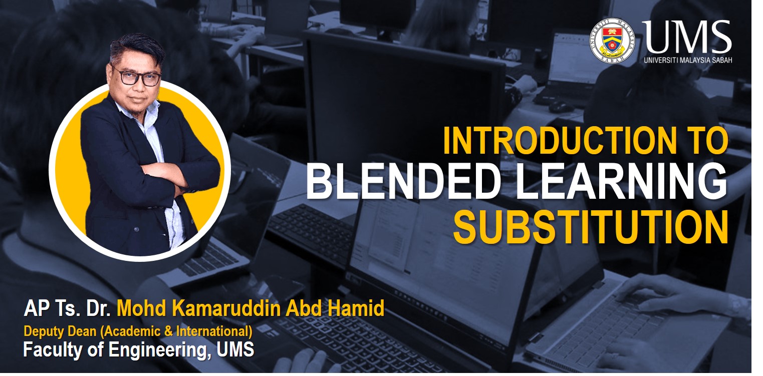
SHARING ON BLENDED LEARNING SUBSTITUTION IMPLEMENTATION
The Blended Learning Substitution (BLS) sharing aims to assist educators at UMS FKJ in effectively implementing blended learning. By providing practical guidance and strategies, the sharing equips educators to seamlessly integrate online resources into traditional teaching methods. The ultimate goal is to establish the sharing as a comprehensive reference for educators as they adopt BLS techniques, enhancing their teaching approaches and enriching the learning experience for students.
SK32603 PRINSIP DAN TEKNOLOGI PROSES KIMIA [2-2022/2023]
This course will discuss about applications of chemistry in industries, such as thermodynamics, materials and energy balance, fluid mechanics, heat transfer, particle technology, mass transfer, distillation, adsorption and extraction, evaporation and drying. Ideal reactors, separation processes, humidification and dehumidification will also be discussed.
SK34803 TEKNOLOGI NANO [2-2023/2024]
This course focuses on the definition, history, scope, impacts, and challenges within the rapidly emerging and revolutionary field of nanotechnology. The course discusses techniques of the production of various nanomaterials such as graphenes, silicenes, nanotubes, nanorods, colloids, dots, clusters, wires, thin films etc. The pros and cons of the “top down” and “bottom up” approach in the nanotechnology will be discussed. The state-of-the-art instruments such as spectroscopy, radiation scattering, scanning electron microscopy, transmission electron microscopy and X-ray diffraction etc. that are important for the characterization of nanomaterial and nanotechnology will be discussed too.
SK34803 TEKNOLOGI NANO [2-2025/2026]
This course focuses on the definition, history, scope, impacts, and challenges within the rapidly emerging and revolutionary field of nanotechnology. The course discusses techniques of the production of various nanomaterials such as graphenes, silicenes, nanotubes, nanorods, colloids, dots, clusters, wires, thin films etc. The pros and cons of the “top down” and “bottom up” approach in the nanotechnology will be discussed. The state-of-the-art instruments such as spectroscopy, radiation scattering, scanning electron microscopy, transmission electron microscopy and X-ray diffraction etc. that are important for the characterization of nanomaterial and nanotechnology will be discussed too.
SK41503 KIMIA FIZIK GUNAAN [1-2023/2024]
This course focuses on the application of physical chemistry to functional materials, state-of-the-art instrument, industrial chemical processes and manufacturing of chemical products. Besides, this course requires students to discuss the importance physical chemistry in some selected analytical and production process through different approaches, such as in the forms of project report and presentation.
![SL31003 PERMODELAN PERSISIRAN PANTAI [2-2022/2023]](https://itel.ums.edu.my/pluginfile.php/40543/course/overviewfiles/bathy.jpg)
SL31003 PERMODELAN PERSISIRAN PANTAI [2-2022/2023]
In recent decades, numerical modelling has evolved into a potent instrument for tackling complex coastal dynamics. Frequently, theoretical and numerical solutions are unavailable or require verification by physical modelling. In such situations, it is necessary to create and test physical models to better comprehend the actual processes involved. This course introduces coastal modelling and the interaction of environmental components in the application of a model in a coastal area. This subject is comprised of software applications, including Surfer, techniques for remote sensing and geographic information system (GIS), and Delft3D DashBoard. Analyses involving data collecting and analysis, mapping, scale and boundary impacts in physical modelling; computer methods used to analyse coastal and estuarine phenomena.
![SM13103 MATEMATIK I [1-2023/2024]](https://itel.ums.edu.my/pluginfile.php/531200/course/overviewfiles/iTel%20Card%20%283%29.jpg)
SM13103 MATEMATIK I [1-2023/2024]
This course provides a comprehensive introduction to several important areas of mathematics, including foundational concepts (logic, set theory, real numbers) and more advanced topics (complex numbers and calculus). It establishes a strong foundation for advancing in the study of mathematics and applying it across various fields.
 iTEL
iTEL